
The Inside on the Outside
The Big Picture WPC
Four tropical systems are turning at once across two oceans this morning, a stalled Southeast front is squeezing out its own flash-flood risk without any help from the tropics, and overnight the Full Sturgeon Moon slid through the deepest partial lunar eclipse in years — 96 percent of its face swallowed by Earth’s shadow, just short of going full blood-red. None of today’s hazards are extreme by NWS category, which is exactly why the story is breadth: severe weather chances stretch from the Great Basin to the Carolinas, flooding risk lines the Gulf and Atlantic coasts, and the week ahead is building toward a long-duration heat wave that will own the center of the country by the middle of next week.
Lead Story: Dolly Aims Rain at the Leewards, Puerto Rico & USVI NHC Advisory 4
Tropical Storm Dolly — Racing West, Rain Outruns the Wind FLASH FLOOD RISK, HIGHER TERRAIN
Dolly is doing something unusual for a system this weak: outrunning its own future. Sustained winds are 40 mph and holding, but the storm is charging west at 21 knots — fast enough that NHC expects it to degenerate into a tropical wave or open low before it ever reaches the islands. The wind threat, in other words, is likely to fade. The rain threat isn’t. Forecasters say the moisture plume survives the storm’s own breakup, with heavy rain reaching the Leeward Islands late Saturday into Sunday, then sliding into the U.S. Virgin Islands, Puerto Rico, and Hispaniola Sunday into Monday — heavy enough to produce flash flooding in higher terrain even after “Dolly” the storm has technically stopped existing. No coastal watches or warnings are up yet; that’s the thing to watch for as the weekend develops.

Trouble Spots
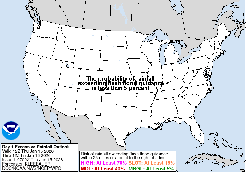
Flooding — Coastal Carolinas into SE Virginia & Coastal Georgia SLIGHT RISK 2/4
A stalled front and a sharpening upper-level jet streak are teaming up to wring out the coastline this afternoon and evening. Guidance has much of the Carolina coast reaching or exceeding 2 inches, with the strongest cells capable of 3 inches an hour where training sets up. A separate, unrelated wrinkle: forecasters are also watching a weak circulation trying to spin up offshore the Florida Panhandle in the next 24 hours — a homegrown feature, not a piece of Dolly — that could focus its own heavy rain near the coast and force an upgrade if it trends inland.
Severe Storms — Northern Great Basin & Northern Plains (Saturday) SLIGHT RISK 2/5
Tomorrow’s severe threat centers on a belt of 40-50 kt mid-level flow overspreading the northern Great Basin into the Dakotas, with severe wind gusts the headline risk. Worth knowing: SPC’s own forecasters flagged that the NAM and RAP models disagree on how moist the airmass will be over the Great Basin corridor — more on that split below in The Inside.
Severe Storms — Plains, Great Basin/SW, Carolinas-Mid-Atlantic, Maine (Today) MARGINAL RISK 1/5
A broad but low-end severe threat today: isolated strong to severe storms with hail and gusty wind are possible from the central/northern Plains through the Great Basin and Desert Southwest into the northern Rockies, plus a separate corridor from north Georgia into the Carolinas and Mid-Atlantic, and a small window over central and eastern Maine this afternoon into evening.
Heat Wave Building — Plains to the Deep South DEVELOPING, EARLY-WEEK ONSET
Nothing extreme is on the map today, but WPC’s extended discussion is unambiguous about what’s coming: an intensifying, long-lasting heat wave builds across the central and southern Plains starting this weekend, then expands into the Midwest, Southeast, and Deep South by the middle of next week. Highs are expected well into the 90s and 100s, with high humidity and overnight lows only easing into the 70s — the kind of pattern that produces Major to Extreme HeatRisk and raises the odds of heat-related illness the longer it runs. Worth planning around if your week ahead touches any of those regions.

The Tropics — Three Basins NHC/CPHC outlooks
Atlantic: One Storm, Already Fading
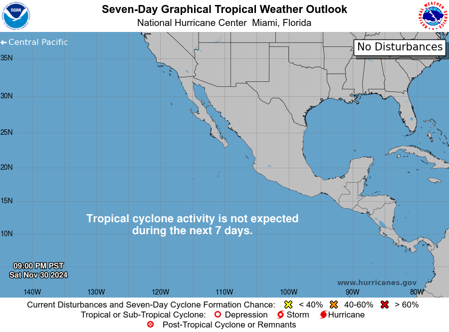
Dolly leads (see above), and it’s the basin’s only business — NHC’s outlook says tropical cyclone formation elsewhere isn’t expected over the next seven days. A single, weakening system is about as quiet as the Atlantic gets while still technically “active.”
East Pacific: The Assembly Line Is Running
Two storms, two very different forecasts, same basin. Karina — 50 mph now, located well southwest of Baja — is forecast to become what NHC’s own bulletin calls a “formidable hurricane” well offshore southwest Mexico, with the official track showing sustained winds near 100 kt (roughly 115 mph, major-hurricane strength) by early next week. Lowell, currently 45 mph and drifting east-northeast before a forecast turn west, is expected to reach hurricane strength over the weekend and approach major-hurricane intensity (95 kt) by day five. Both stay over open water in the official forecast — no watches or warnings are up for either.
Central Pacific: Lala’s Last Advisory
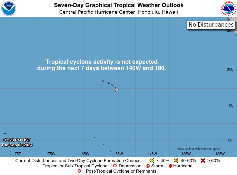
Post-Tropical Cyclone Lala got its final NHC advisory overnight — 15 days as a named system, opened into a remnant low well north of Kure Atoll and now forecast to dissipate within a couple of days. CPHC flags a separate area of low pressure that could organize southwest of Hawaii around midweek next week (medium, 40 percent, chance through 7 days) — worth a glance, not yet a headline.
The Inside what the discussions actually say
The reasoning behind the forecast, pulled from the technical discussions forecasters write for each other.
“Formidable” isn’t a throwaway word. NHC’s public bulletin on Karina specifically flags it as forecast to become a “formidable hurricane well offshore” — language the agency doesn’t reach for casually. The forecast track backs it up: from 50 mph today to roughly 115 mph (100 kt) by early next week, a jump of more than 60 mph in five days. That’s the kind of intensification rate that separates an ordinary hurricane forecast from one that gets a specific adjective attached.
Forecasters split their own models, and said so. For Saturday’s severe threat over the northern Great Basin, SPC’s discussion admits the NAM and RAP guidance don’t agree — RAP shows richer low-level moisture (dewpoints over 60°F) with steeper lapse rates and 2,000+ J/kg of available energy; NAM shows drier air in the upper 40s to low 50s and a less unstable atmosphere. Both still agree on enough instability and shear for supercells, which is why the Slight Risk stands — but naming the disagreement instead of splitting the difference quietly is the kind of honesty a forecast discussion is for.
The Southeast’s flood risk has two authors, not one. It would be easy to assume the Carolina coast’s rain threat is a Dolly story. It isn’t — Dolly’s rain is aimed at the islands, a thousand-plus miles away. The domestic flood risk is homegrown: a stalled front, a strengthening jet streak, and a separate weak circulation trying to organize offshore the Florida Panhandle. Two systems, two oceans apart, both raising flood risk on the same coastline this weekend — coincidence of timing, not cause.
One basin quiet, one basin running hot — same week, same hemisphere. The Atlantic has exactly one storm and no one else on deck for a week. The East Pacific has two systems both forecast to reach hurricane strength within days of each other, one of them likely major. Same calendar week, same planet, opposite outcomes — a reminder that “tropical season” isn’t one season, it’s several running on different clocks in different oceans.
Looking Ahead CPC · current issuance; next ~3 PM today
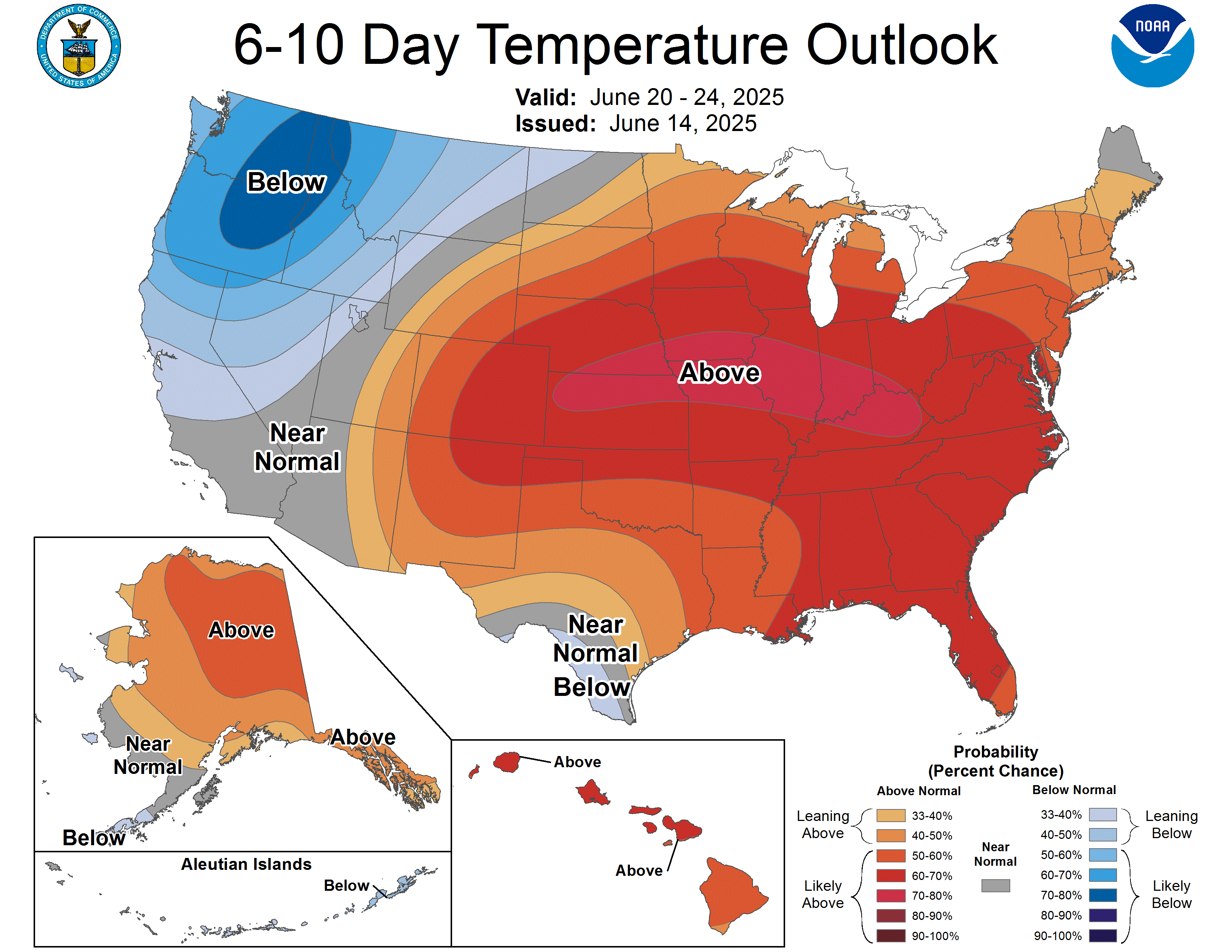
For the 6-14 day window: above-normal temperatures are favored across the Southwest and the Central and Eastern U.S., with the strongest signal — 80 to 90 percent odds — over the south-central states, consistent with the heat wave building in Trouble Spots above. The West Coast and Northern Rockies lean below normal under continued troughing, stretching as far south as south-central California. On the precipitation side, above-normal rain is favored across the West and Pacific Northwest, with the best odds (60-70 percent) in the Pacific Northwest specifically. CPC’s own confidence framing: moderate — model guidance agrees on the broad pattern but the ensemble spread is real, which is why forecasters split their weighting toward the two models (ECMWF/GEFS ensembles) they trust most for this stretch.
Also Watching
- Aurora Watch: Space weather is genuinely active — unsettled to G1 (Minor) storm levels arrived early today as a positive-polarity coronal hole stream reaches Earth, with G2 (Moderate) levels likely later today as CMEs that left the Sun August 25-26 arrive on top of it. G1-G2 conditions are expected to persist into Saturday before easing Sunday. If skies stay clear, that’s aurora-viewing potential well south of the usual latitudes tonight and tomorrow night. Separately, there’s a 45 percent chance of an M-class solar flare (10 percent X-class) from an active sunspot region through Sunday. SWPC
- Fire Weather: Elevated conditions today in northeast California into southeast Oregon (surface trough, 15-20 mph winds, 10-20% humidity over dry fuels) and northwest Montana (dry downslope winds off the terrain). A few isolated thunderstorms are possible over Southern California’s coastal ranges and Transverse Ranges too, with dry fuels supporting a lightning-ignition risk despite limited rainfall. Saturday shifts the elevated area to southeast Oregon/northwest Nevada as a Pacific Northwest upper low organizes. SPC Fire Wx
- Drought Monitor: Weekly product, last updated Tuesday for conditions through August 25. Next national map — and this section’s regular feature slot — lands Thursday, September 3.
- Marine: A Tropical Storm Warning remains up for Dolly’s path across the open North Atlantic, plus a Gale Warning over the far North Atlantic tied to an unrelated low near 57N/40W. Mariners in either zone should consult the full OPC High Seas Forecast. OPC
Look Up Tonight
Waning Gibbous · ~99% illuminated. The Full “Sturgeon Moon” hit exactness overnight, in the middle of a very deep partial lunar eclipse — full recap in One Cool Thing below. Tonight the moon still looks essentially full to the eye as it rises this evening.
One Cool Thing
Overnight, the Moon came within a hair of turning red. A partial lunar eclipse peaked around 12:13 AM ET, and Earth’s shadow ended up covering roughly 96 percent of the lunar disk — deep enough that the shaded portion likely took on a coppery tint, but just shy of the 100 percent coverage that defines a total “Blood Moon” eclipse. It was visible across the Americas, Europe, and Africa, weather permitting. If you missed it, the wait for the next one is short by eclipse standards but long by any other measure: the next total lunar eclipse visible from the U.S. isn’t until New Year’s Eve 2028 into New Year’s Day 2029.
Shareables
Source Ledger every claim, timed & sourced
Our standard: nothing in this briefing older than 8 hours without a flag. Products that update once daily or weekly are used at their most recent issuance and marked.
| Product | Issued | Status |
|---|---|---|
| WPC Short-Range Forecast Discussion | 3:26 AM EDT Fri Aug 28 | CURRENT |
| WPC Extended (Day 3–7) Forecast Discussion | 2:10 AM EDT Fri Aug 28 | CURRENT |
| WPC Excessive Rainfall Discussion | 4:06 AM EDT Fri Aug 28 | CURRENT |
| SPC Day 1 / Day 2 / Day 3 Convective Outlooks | 2:00 / 1:53 / 3:21 AM EDT Fri | CURRENT |
| SPC Day 1–2 Fire Weather Outlooks | 1:17 / 1:18 AM EDT Fri Aug 28 | CURRENT |
| NHC Atlantic Tropical Weather Outlook | 2:00 AM EDT Fri Aug 28 | CURRENT |
| NHC East Pacific Tropical Weather Outlook | 2:00 AM EDT Fri Aug 28 | CURRENT |
| CPHC Central Pacific Tropical Weather Outlook | 2:00 AM EDT Fri Aug 28 | CURRENT |
| NHC Tropical Storm Dolly Advisory No. 4 | 5:00 AM EDT Fri Aug 28 | CURRENT |
| NHC Tropical Storm Karina Advisory No. 3 | 4:00 AM EDT Fri Aug 28 | CURRENT |
| NHC Tropical Storm Lowell Advisory No. 3 | 5:00 AM EDT Fri Aug 28 | CURRENT |
| NHC/CPHC Post-Tropical Cyclone Lala Advisory No. 64 (final) | 5:00 AM EDT Fri Aug 28 | CURRENT |
| CPC 6-10 / 8-14 Day Prognostic Discussion | 3:00 PM EDT Thu Aug 27 | CURRENT ISSUANCE · daily product; next ~3 PM today |
| SWPC Space Weather Forecast Discussion | 8:30 PM EDT Thu Aug 27 (0030 UTC) | CURRENT |
| OPC High Seas Forecast (N. Atlantic) | 6:30 AM EDT Fri Aug 28 | CURRENT |
| US Drought Monitor National Summary | Data through Tue Aug 25; released Aug 27 | CURRENT ISSUANCE · weekly product; next Thu Sep 3 |
For Newsrooms & Reporters
Need a Meteorologist On Air or On the Record Today?
Bob Cox — veteran broadcast meteorologist heard mornings on WTIC NewsTalk 1080 (Hartford) and forensic meteorologist with 30+ years analyzing high-impact weather — tracks these stories in real time and is available for interviews and expert comment: radio, TV, print, podcast, fast turnaround.
Today’s interview-ready angles: Dolly’s flash-flood threat to the Leeward Islands, Puerto Rico & USVI · Karina and Lowell’s rapid climb toward hurricane strength in the East Pacific · overnight’s near-total partial lunar eclipse of the Sturgeon Moon · the long-duration heat wave building toward the Deep South next week.
BOOKING: kaitlin@coxweatherservices.com · 888-248-9347 · coxweatherservices.com · attribution: “Bob Cox, meteorologist, Cox Weather Services”