
The Inside on the Outside
The Big Picture WPC
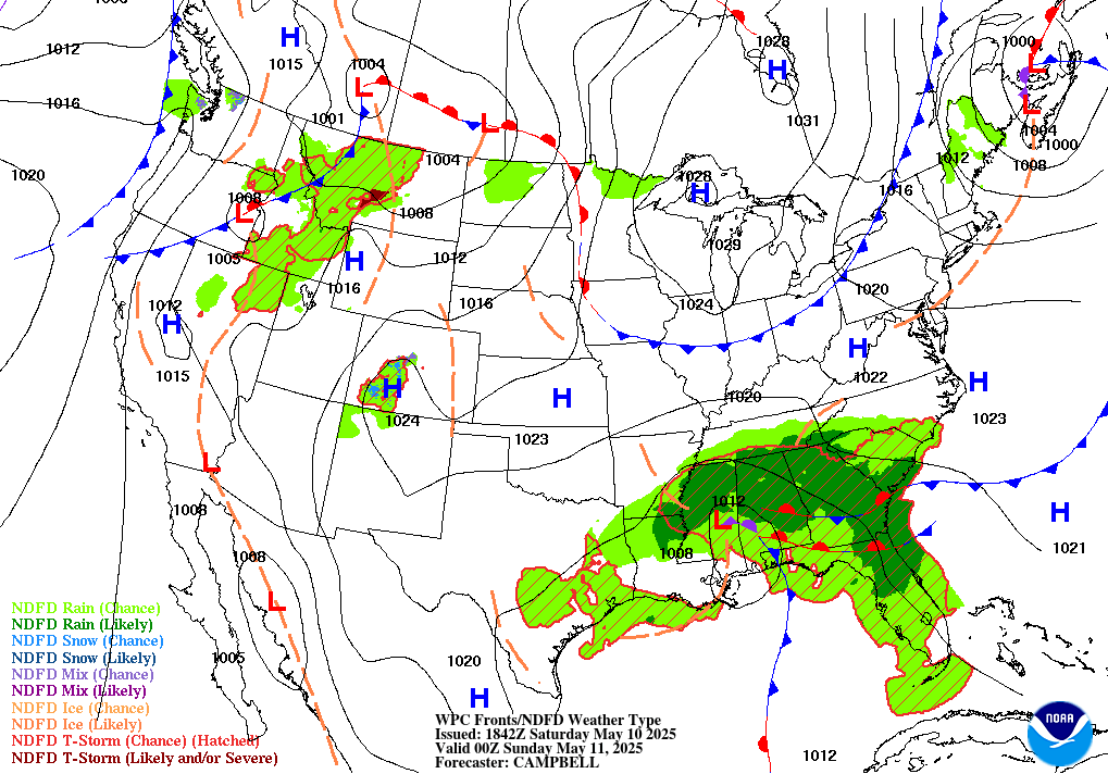
Sunday’s map is really two stories moving at very different speeds. Far out over open water, two tropical cyclones are strengthening on roughly parallel tracks: Karina became a hurricane overnight off the Mexican Pacific coast and is forecast to reach major-hurricane strength within a day, while 1,150 miles southeast of Hawaii, Lowell crossed into the Central Pacific basin this morning and is trending toward hurricane strength of its own. Neither threatens land right now — but there’s a real chance the two storms’ wind fields start interacting with each other later this week, which would complicate both forecasts. Closer to home, the bigger story is persistence: the heat dome anchored over the central and southern Plains keeps building and is forecast to expand toward the Midwest, Mid-Atlantic, and Southeast through the week, pushing widespread Major-to-Extreme HeatRisk into a South that’s already seeing rapid, heat-driven drought expansion. Meanwhile a slow-moving plume of monsoon moisture keeps Utah and Arizona under a flash-flood-worthy setup for a second straight day.
Storm Reports Recap SPC · previous 24 hours
Yesterday’s severe weather stayed on the modest side of the ledger. The Storm Prediction Center logged zero tornado reports nationwide, but scattered wind damage stretched from the Great Basin and Rockies into the northern Plains, and an isolated storm near Tucson knocked out power to roughly 1,800 customers. Hail stayed pea-to-ping-pong-ball sized across a South Dakota corridor, capping a quiet-but-not-uneventful 24 hours.

Trouble Spots

Southwest Flash Flood Risk SLIGHT RISK 2/4
A deep, positively-tilted trough swinging across the Intermountain West has dragged anomalous monsoon moisture into Utah and Arizona for a second straight day. Radar has already shown cell training and backbuilding — thunderstorms redeveloping over the same spots instead of moving through — and that pattern is expected to continue into early Monday. Slot canyons, burn scars, dry washes, and urban drainage are the highest-risk terrain; hourly rain rates could approach 2 inches where cells merge.
Scattered Severe Risk, N. Plains to Great Basin MARGINAL RISK
An upper low ejecting out of Saskatchewan and a surface low forming near the Montana/North Dakota line will trail a cold front across the Dakotas overnight, capable of a line of storms with severe gusts, hail over an inch, and an isolated tornado near the boundary’s warm-front end. Separately, an unseasonably moist air mass over eastern Utah into western Colorado (dewpoints near 60°F) could support a few organized clusters or supercells given strong unidirectional westerly flow aloft.
Tuesday: Lower Hudson Valley Severe Watch SLIGHT RISK 2/4 (DAY 3)
Two days out, SPC has already introduced a Slight Risk for a corridor of the Lower Hudson Valley — an early flag, not a lock. The setup: a mid-level impulse pivoting out of the Great Lakes into rich, low-70s-dewpoint air, with curved, elongated hodographs that suggest a few storms could take on supercell structure. Severe wind and hail are the headline threats, and forecasters say a tornado can’t be ruled out. Worth watching as it comes into range.
Dangerous Heat Builds East MAJOR–EXTREME HEATRISK
High temperatures well into the 90s and 100s will persist from the central and southern Plains into the Midwest, Mid-Atlantic, and Southeast through midweek, with overnight lows only falling into the 70s to near 80. That combination of heat, humidity, and warm nights is what pushes HeatRisk into the Major-to-Extreme category — the muggy air itself, not cloud cover, is what’s blocking the overnight cooldown (more on that below). Some relief arrives in the Ohio Valley and Mid-Atlantic by next weekend as a cold front presses south, but the core of the heat likely holds on toward the Mid/Lower Mississippi Valley into next week.
The Tropics — Three Basins
Atlantic — Quiet, Two Things to Watch LOW CHANCE
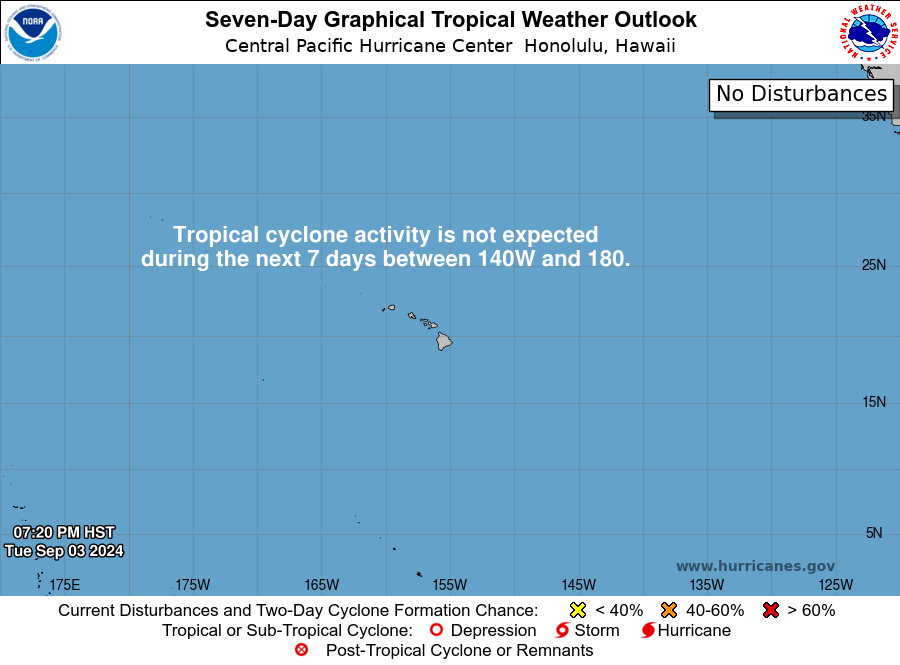
The remnants of Tropical Storm Dolly continue to produce showers and thunderstorms just east of the northern Leeward Islands, but with no closed circulation and the wave racing west-northwest at 25 mph, redevelopment is unlikely (7-day chance: 10%, low). It could still bring locally heavy rain and gusty wind to the Leewards, Virgin Islands, and Puerto Rico over the next couple of days. Separately, a weak, disorganized area of low pressure about 100 miles south of southeast Louisiana may develop slowly as it drifts west across the northern Gulf this week (7-day chance: 20%, low) — worth a watch for Louisiana and the upper Texas coast.

East Pacific — Hurricane Karina Intensifying CAT 1 → MAJOR FORECAST
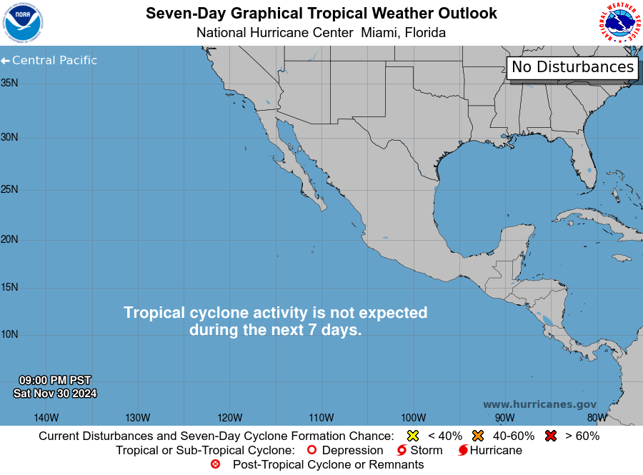
Karina became a hurricane overnight and is centered about 820 miles west-southwest of the southern tip of Baja California with 80 mph winds, moving west-northwest at 15 mph — well offshore, no coastal watches. Now that the storm has developed a closed, symmetric core, NHC expects steady-to-rapid strengthening, with Karina forecast to reach major-hurricane strength (115+ mph) within about a day and peak near 120 mph by Monday night before a weakening trend sets in around midweek as it moves over cooler water. A second disturbance well offshore southwestern Mexico has a high (90%) chance of becoming a tropical depression early-to-mid next week.
Central Pacific — Lowell Crosses the Line TS → HURRICANE FORECAST
Tropical Storm Lowell crossed from the East Pacific into the Central Pacific basin this morning, handing off from NHC to the Central Pacific Hurricane Center. Currently a 50 mph tropical storm about 1,150 miles southeast of Hawaii and moving west at 10 mph, Lowell is sheared for now but forecast to strengthen as that shear relaxes, becoming a hurricane by Monday night and continuing to intensify through midweek. The wild card: Lowell’s longer-range track has unusually large spread, in part because a slower, more northwestward path could bring it close enough to Karina’s outflow to expose it to fresh shear — while a farther-south track would let it keep strengthening undisturbed. Separately, a broad area of low pressure could form south or southwest of Hawaii in the next few days (7-day chance: 30%, low).
The Inside Decoded
A trough is just a dip in the upper-level winds — picture a lazy river bending south. Most troughs tilt from southwest to northeast (“positively tilted”), the more common, steadier orientation. Because a positively tilted trough doesn’t deepen and race off the way a sharper system does, it can act as a longer-duration moisture pump — holding a tropical air feed in place for days instead of hours. A negatively tilted trough leans the other way, from northwest to southeast, and tends to sharpen storms fast as it deepens. Today’s setup over the Intermountain West is the positively tilted kind, which is exactly why Utah and Arizona have been stuck under the same monsoon plume for two straight days instead of getting a quick hit and moving on.
Karina and Lowell aren’t close enough for the classic Fujiwhara dance, where two storms literally orbit a shared center. But a hurricane’s influence reaches well past its eyewall — its outflow (the exhaust of air spreading out at the top of the storm) can add wind shear hundreds of miles away, which is exactly the kind of disruption that keeps a nearby storm weaker than it “should” be. That’s the mechanism NHC is watching in Lowell’s forecast: track it slightly closer to Karina, and shear from Karina’s outflow could cap Lowell’s strength; track it farther away, and Lowell is free to intensify on its own timeline.
A 102°F afternoon sounds like the headline, but forecasters watch the overnight low just as closely — because a body that never gets a break from heat overnight has no chance to recover before the next hot day. When humidity is high, water vapor in the air traps outgoing heat overnight the same way a blanket does, which is why lows are only falling into the 70s and near 80 across the heat-dome zone even under clear skies. That combination — heat plus humidity plus no overnight relief — is precisely what NWS’s HeatRisk tool is built to flag as Major or Extreme.
When SPC introduces a Slight Risk two days out — like Tuesday’s Lower Hudson Valley setup — they’re explicitly telling you the ingredients look right in a broad sense (moisture, instability, some rotation potential) but that the exact placement of any focusing boundary is still too fuzzy to pin down. It’s less “storms are coming to your town” and more “start paying attention here,” with the expectation that Monday’s and Tuesday’s outlooks will sharpen or shrink the area considerably.
Looking Ahead CPC 6–10 & 8–14 Day
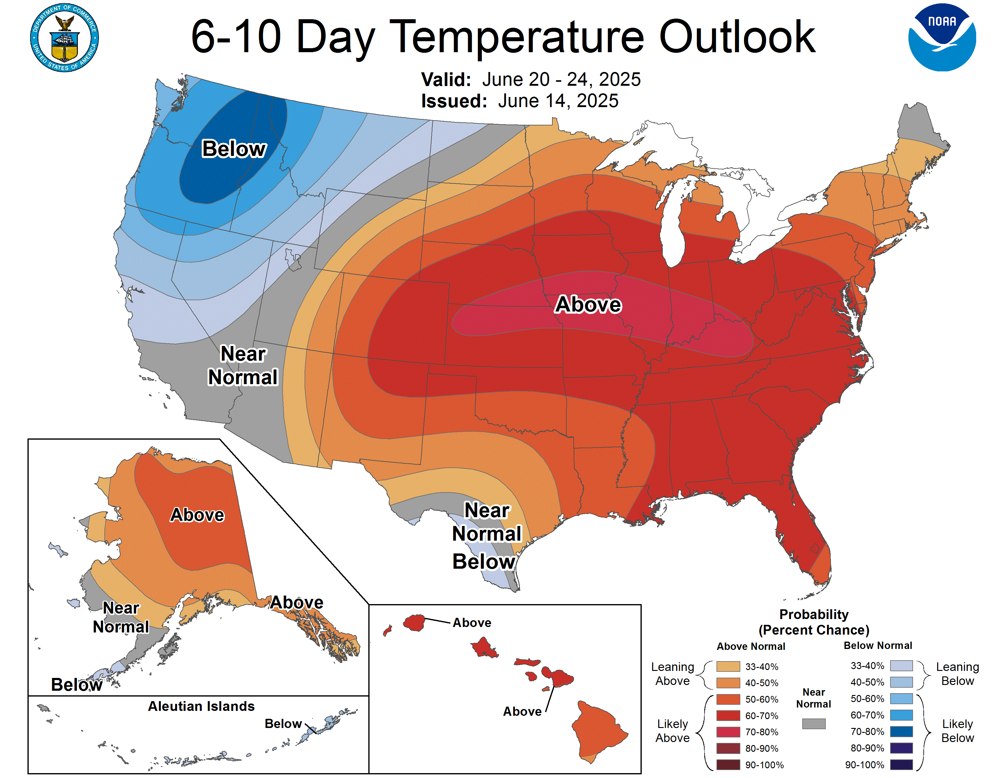
Confidence is moderate (3/5) for the 6-10 day window (Sept 4–8): a high-amplitude ridge holds over the central and southern Plains, with high confidence (greater than 80%) for above-normal temperatures there and expanding east of the Rockies generally. Below-normal temperatures are favored for the Pacific Northwest and northern California as anomalous troughing digs in — that’s the same system forecast to bring a strong Pacific storm and possible atmospheric river to the Pacific Northwest Wednesday into Thursday, with downstream impulses raising the risk of heavy rain and severe weather from the northern Plains and Upper Midwest into the Great Lakes, Mid-Atlantic, and Northeast (Wednesday stands out for the Interior Northeast and New England specifically). Confidence drops to below-average (2/5) for the 8-14 day window (Sept 6–12) as the pattern de-amplifies, but the lean toward continued Plains-to-Southeast heat persists, with a modest wet tilt for the northern Plains, western Great Lakes, and Florida Peninsula, and dry odds favored for the central/southern Plains, Mid-Mississippi Valley, Ohio Valley, and Mid-Atlantic.
Also Watching
- Space Weather: Active geomagnetic conditions today as a positive-polarity coronal hole stream and lingering effects from CMEs that left the Sun on Aug 25–26 combine — solar wind topped 525 km/s with Bz dipping to -11 nT overnight. A modest aurora display is possible for the northern-tier U.S. after dark tonight; conditions should quiet back down by Monday. Separately, there’s a chance for M-class solar flares Sunday through Tuesday as an active sunspot region rotates across the disk.
- Fire Weather: A genuinely quiet national map today, with one modest exception: relative humidity dropping to 20–25% alongside 15–20 mph winds will bring elevated fire weather conditions to the Texas Panhandle into western Oklahoma and south-central Kansas this afternoon. Monday brings a smaller, marginally elevated area to northeastern California and south-central Oregon.
- Drought Monitor: Current issuance · Aug 25 The heat dome is doing exactly what heat domes do to soil moisture — rapid drought expansion continued across Texas, Oklahoma, Louisiana, and Arkansas this past week, with weekly highs topping 100°F across nearly the entire South and peaking above 110°F along the Texas-Oklahoma border. Extreme-to-Exceptional drought also expanded in the Pacific Northwest and northeastern Idaho. Next update Thursday, September 3.

Look Up Tonight
A waning gibbous moon, about 92% illuminated, rises in the east not long after sunset tonight — bright enough to wash out fainter stars but still a striking sight. It’s the tail end of last week’s action: the Moon reached full phase Friday, and a partial lunar eclipse swept across it early Friday morning. Next up is the last-quarter Moon in a few nights.
One Cool Thing
Those ping-pong-ball-sized hailstones reported near Bowdle, South Dakota yesterday didn’t get that big by accident — they got big by going up and down. A hailstone forms when a tiny ice pellet gets caught in a thunderstorm’s updraft, rides high enough to pick up a fresh layer of supercooled water, then falls, then gets tossed back up again — sometimes half a dozen times — before the storm’s updraft finally can’t hold its weight anymore and lets it fall to the ground. Slice one of those stones in half and you’d see rings, almost like a tree trunk, each one a record of another trip through the storm.
Shareables
For Newsrooms & Reporters
Bob Cox — veteran broadcast meteorologist heard mornings on WTIC NewsTalk 1080 (Hartford) and forensic meteorologist with 30+ years analyzing high-impact weather — is available for live hits, phoners, or background on any story in this issue: dual East/Central Pacific hurricane intensification, the expanding South-Central heat dome, or the Southwest flash-flood setup.
Reply here or call 888-248-9347. Public-domain NOAA/NWS imagery in this issue is cleared for broadcast use with standard attribution — no licensing required.
Source Ledger
Every forecast in this issue traces back to a named NWS/NOAA product below. Status shows how fresh each source was at publication.
| Product | Issuance | Status |
|---|---|---|
| WPC Short-Range Forecast Discussion | 2:21 AM EDT Sun Aug 30 | CURRENT |
| WPC Extended (Days 3–7) Discussion | 3:03 AM EDT Sun Aug 30 | CURRENT |
| WPC Excessive Rainfall Discussion | 4:22 AM EDT Sun Aug 30 | CURRENT |
| SPC Day 1 Convective Outlook | 1:53 AM CDT Sun Aug 30 | CURRENT |
| SPC Day 2 Convective Outlook | 1:53 AM CDT Sun Aug 30 | CURRENT |
| SPC Day 3 Convective Outlook | 2:23 AM CDT Sun Aug 30 | CURRENT |
| SPC Storm Reports (D-1, D-2 CSV) | 4:13 AM EDT Sun Aug 30 | CURRENT |
| SPC Day 1–2 Fire Weather Outlook | 12:30–12:31 AM CDT Sun Aug 30 | CURRENT |
| NHC Atlantic Tropical Weather Outlook | 2:00 AM EDT Sun Aug 30 | CURRENT |
| NHC East Pacific Tropical Weather Outlook | 11:00 PM PDT Sat Aug 29 | CURRENT |
| Hurricane Karina Advisory 11 (NHC) | 2:00 AM PDT Sun Aug 30 | CURRENT |
| Tropical Storm Lowell Advisory 11 (NHC, final) | 11:00 PM HST Sat Aug 29 | CURRENT |
| CPC 6–10 / 8–14 Day Prognostic Discussion | 3:00 PM EDT Sat Aug 29 | CURRENT ISSUANCE |
| SWPC Forecast Discussion | 12:30 AM UTC Sun Aug 30 | CURRENT |
| OPC High Seas Forecast (N. Atlantic) | 10:30 UTC Sun Aug 30 | CURRENT |
| US Drought Monitor National Summary | Thu Aug 25 2026 | CURRENT ISSUANCE |
| WPC basicwx NDFD lead graphic | Live fetch at build | CURRENT |
Summaries of official NWS/NOAA forecasts. For warnings in effect, see weather.gov. For tropical specifics, see hurricanes.gov.