
THE INSIDE ON THE OUTSIDE
The Big Picture WPC · Short-Range Discussion
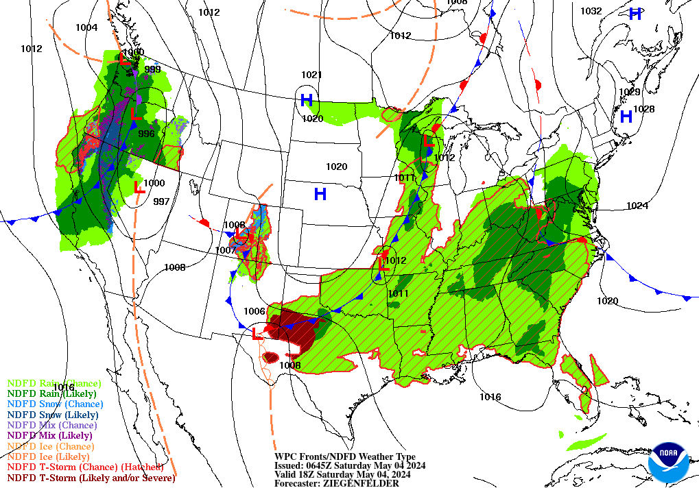
Two very different threats are colliding today. Tropical Storm Edouard is closing in on the upper Texas coast and could approach hurricane strength before it comes ashore later today, even as a dangerous, expanding heat wave keeps building across the nation’s midsection. Edouard has a short window over very warm Gulf water — forecasters expect most of its strengthening to happen in the final hours before landfall near Galveston Bay tonight, with a narrow but intense corridor of rain trailing behind it into east-central Texas. Meanwhile, WPC’s extended outlook shows little relief from the heat through the weekend for the Plains, Mississippi Valley, and Southeast, with widespread Major to Extreme HeatRisk and unusually warm overnight lows compounding the danger. A slight risk of severe storms also stretches today from the Central/Northern Plains into the Lower Great Lakes, New York, and New Jersey, where a very unstable air mass and increasing wind shear favor a mix of supercells and line segments.
Lead Story NHC · TS Edouard Advisory 3A
Tropical Storm Edouard Closing In on the Texas Coast
Edouard was centered about 85 miles southeast of Cameron, Louisiana (115 miles southeast of Port Arthur, Texas) as of the latest advisory, moving west-northwest at 7 mph with 40 mph sustained winds. NHC’s forecast calls for strengthening through the morning — with the peak intensity expected right around landfall — and Edouard could be near hurricane strength when the center reaches the coast within the Hurricane Watch area later today. It’s forecast to move inland over southeast Texas tonight and weaken quickly, dissipating by Wednesday night.
A Storm Surge Warning covers High Island, Texas to the Vermilion/Cameron Parish Line, Louisiana (3–5 feet of inundation possible above ground near the coast), with a Hurricane Watch from High Island to Cameron and a Tropical Storm Warning from Port Bolivar to the Vermilion/Iberia Parish Line. Rainfall is the other half of the story: 3–6 inches are expected across the Upper Texas Coast into east-central Texas, with isolated totals to 9 inches, plus 2–3 inches into far southwest Louisiana — enough for flash flooding, especially in urban areas, with river flooding also possible.
Storm Reports Recap SPC · previous 24 hours
A quiet night on the severe side: no tornado reports were logged nationwide in the 24 hours ending 6:00 AM EDT today. The most active corner of the country was the Central/Southern Rockies and High Plains, where thunderstorm outflow and downslope gusts topped 60 mph repeatedly across Colorado, Utah, Arizona, New Mexico, and Kansas — eleven wind reports in all, including a personal-weather-station-measured 77 mph gust near Lamar, Colorado. The lone hail report of the window came from far southeastern Nevada, where quarter-sized (1.00″) hail fell at Kershaw-Ryan State Park near Caliente.

Trouble Spots
Flooding SLIGHT RISK 2/4
Edouard is the headline: a Slight Risk covers the Upper Texas Coast and far southwest Louisiana today, with heavy rain continuing into Wednesday as the system’s remnants lift slowly north through east-central Texas. A separate Slight Risk sets up Wednesday for the Northeast, where a stronger shortwave interacting with a warm front favors training thunderstorms across upstate New York. Out west, the multi-day monsoon flooding threat over the Four Corners and Southwest is finally waning today, but a Marginal Risk continues.
Severe Weather SLIGHT RISK 2/5
Scattered strong to severe storms are possible today across the Central/Northern Plains and Midwest, and separately across southern New York, Pennsylvania, and New Jersey, where a very unstable air mass (MLCAPE 3000+ J/kg) south of a warm front, combined with increasing shear ahead of a mid-level speed max, favors a mix of supercells and line segments. Damaging gusts and isolated hail are the most likely hazards, with a couple of tornadoes possible where low-level shear is strongest near the southern Hudson Valley.
Heat DANGEROUS & EXPANDING
A late-summer heat wave shows no sign of breaking. Heat Advisories are posted over the Middle/Lower Mississippi Valley and Ohio Valley today, and WPC’s extended outlook has the heat building into the Ohio/Tennessee Valleys and Mid-Atlantic by Wednesday and Thursday before any relief arrives this weekend. Overnight lows in the mid-70s are doing as much damage as the daytime highs — bodies don’t get a break to recover. Check on neighbors, especially those without reliable air conditioning.
The Tropics — Three Basins NHC / CPHC
Atlantic — Tropical Storm Edouard
Edouard (see Lead Story) is the only active system, closing in on the Texas/Louisiana coast with landfall expected today. No new tropical cyclone formation is expected across the Atlantic, Caribbean, or Gulf over the next 7 days.

East Pacific — Two Hurricanes and a Newcomer
Hurricane Karina is a powerful Category 4 (130 mph) far offshore — about 1,135 miles west-southwest of the southern tip of Baja California — and poses no threat to land, though its swells are spreading north and are likely to bring life-threatening surf and rip currents to Southern California through midweek. Tropical Storm Lowell, well southeast of Hawaii, is rapidly intensifying and forecast to become a major hurricane by Wednesday; NHC’s key message flags that Lowell could be in the vicinity of the Hawaiian Islands late this week or this weekend, and interests there should monitor its progress. A third system — an area of low pressure about 500 miles south-southwest of Manzanillo, Mexico — has a 90% chance of becoming a tropical depression or storm within 48 hours, with advisories likely to begin as soon as Tuesday.

Central Pacific — Karina and Lowell Approaching
No new formation is expected within the Central Pacific basin itself over the next 7 days, but both Karina and Lowell are tracking west-northwest toward the 140°W boundary and could cross into CPHC’s area of responsibility within days. That proximity is already showing up in CPC’s outlook, which favors above-normal precipitation for Hawaii through mid-September as both storms pass by.

The Inside decoded forecaster language
What forecasters mean by “training”
WPC’s rainfall discussion leans hard on this word today. Picture a line of thunderstorm cells moving one after another over the exact same stretch of ground, like train cars rolling down the same track — each one dumps its rain on top of the last. That’s how a storm that never looks especially intense on radar can still produce flash flooding: it’s not one storm’s strength, it’s how many pass over the same spot.
Why a small storm can sneak up on you
Edouard is forecast to strengthen fast — from 40 mph to near hurricane strength in about half a day. That’s not unusual for a compact storm: with less mass to organize, a small tropical cyclone over warm water and low wind shear can spin up (or down) much faster than a large one. Size, as much as intensity, sets the clock.
When the models can’t agree
WPC’s extended discussion is unusually candid about a fight in the guidance: the GFS model keeps showing the disturbance off Mexico (soon to be a tropical cyclone) tracking closer to Southern California and the Southwest, while most other guidance — including the AI/ML tools now standard in the mix — favors a track that stays farther out to sea. Forecasters’ answer: lean on the majority for now, and watch the trend over the next few days rather than commit to the outlier.
Confidence numbers are part of the forecast, not an afterthought
CPC grades its own outlooks: “Average, 3 out of 5” for the 6–10 day period, dropping to “Below Normal, 1 out of 5” for days 8–14. That’s forecasters telling you how much to trust the numbers, not just what the numbers are — a forecast further out isn’t necessarily wrong, it’s just carrying a wider range of what could happen.
Looking Ahead CPC · 6–10 Day Outlook
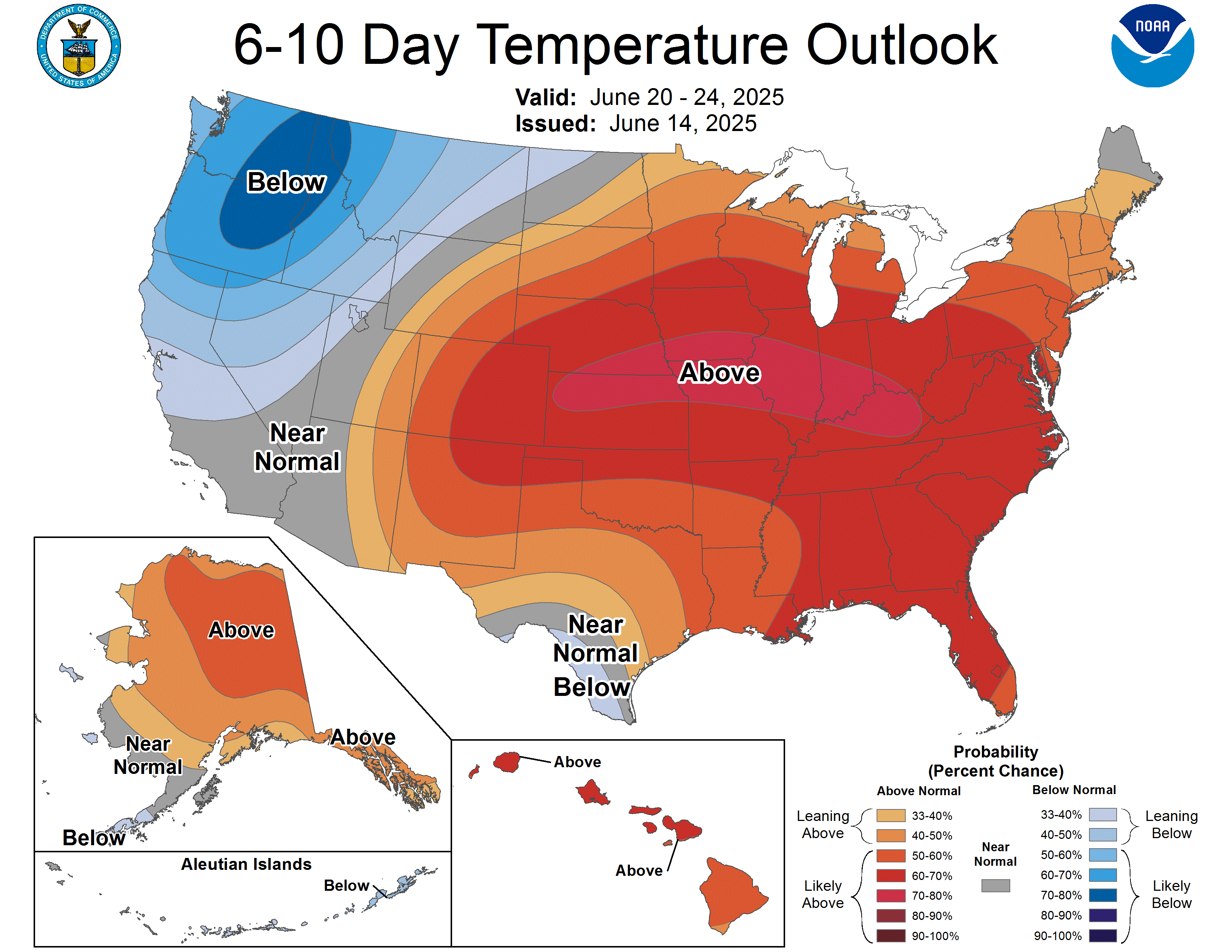
Confidence: Average (3 out of 5). Above-normal temperatures are favored across most of the country east of the Rockies for September 6–10, with the highest confidence (greater than 70% chance) over the Central and Southern Plains, near the center of an anomalous ridge. Near-to-below-normal temperatures continue over the Pacific Northwest and northern California under lingering troughing. On precipitation, above-normal totals are likely across the western U.S. — partly fed by tropical moisture from the developing East Pacific system — while below-normal precipitation is favored from the Southern Plains through the Mississippi Valley into the Great Lakes, Northeast, and Mid-Atlantic. Hawaii is tilted wetter than normal as Lowell and Karina both pass through the neighborhood.
Also Watching
Fire weather: An Elevated risk is in place this afternoon into this evening across the far western Great Basin — northeastern California, far northwestern Nevada, and south-central Oregon — as a Pacific system moves onshore, bringing gusty southwest winds of 10–20 mph and afternoon humidity falling to 10–15%.

Space weather: Quiet. Solar activity is running at low levels with no Earth-directed CMEs observed, and the geomagnetic field is expected to settle to mostly quiet conditions through Thursday after some early unsettled activity today. Nothing aurora-relevant on the horizon.
Drought: Rapid drought expansion is continuing across the South — Texas, Oklahoma, Louisiana, and Arkansas — under a persistent heat-dome ridge, with weekly maximum temperatures topping 100°F across nearly the entire region last week. Next Drought Monitor update: Thursday.
Look Up Tonight
One Cool Thing
Two tropical cyclones, two very different stories today. Tropical Storm Edouard has 40 mph winds and is threatening a populated stretch of the Texas coast tonight. Halfway across the Pacific, Hurricane Karina is a Category 4 monster with winds over three times as strong — and it’s a complete non-event, spinning harmlessly more than 1,100 miles from the nearest coastline. A storm’s category tells you how strong it is. Location tells you how dangerous it is.
For Newsrooms & Reporters
Bob Cox is a veteran broadcast meteorologist heard mornings on WTIC NewsTalk 1080 (Hartford) and a forensic meteorologist with 30+ years analyzing high-impact weather. Available for live hits, phone interviews, and expert comment on today’s Texas landfall, the ongoing heat wave, or the East Pacific’s active tropical stretch.
Reach Kaitlin at kaitlin@coxweatherservices.com or 888-248-9347 to book. coxweatherservices.com
Source Ledger
Every forecast in this issue traces back to a named NWS/NOAA product below. Status shows how fresh each source was at publication.
| Product | Issued | Status |
|---|---|---|
| WPC Short-Range Forecast Discussion | 3:59 AM EDT Tue Sep 1 | CURRENT |
| WPC Excessive Rainfall Discussion (Day 1-5) | 4:40 AM EDT Tue Sep 1 | CURRENT |
| WPC Extended Forecast Discussion | 3:59 AM EDT Tue Sep 1 | CURRENT |
| SPC Day 1 Convective Outlook | 1:03 AM CDT Tue Sep 1 | CURRENT |
| SPC Day 1 Fire Weather Outlook | 1:03 AM CDT Tue Sep 1 | CURRENT |
| NHC Atlantic Tropical Weather Outlook | 2:00 AM EDT Tue Sep 1 | CURRENT |
| Tropical Storm Edouard Advisory No. 3A (NHC) | 1:00 AM CDT Tue Sep 1 | CURRENT |
| NHC East Pacific Tropical Weather Outlook | 11:00 PM PDT Mon Aug 31 | CURRENT |
| Hurricane Karina Advisory No. 19 (NHC) | 5:00 PM HST Mon Aug 31 | CURRENT |
| Tropical Storm Lowell Advisory No. 18 (NHC/CPHC) | 5:00 PM HST Mon Aug 31 | CURRENT |
| CPHC Central Pacific Tropical Weather Outlook | 8:00 PM HST Mon Aug 31 | CURRENT |
| CPC 6-10/8-14 Day Prognostic Discussion | 3:00 PM EDT Mon Aug 31 | CURRENT ISSUANCE |
| SPC Storm Reports, D-1/D-2 (filtered CSV) | fetched 4:13 AM EDT Tue Sep 1 | CURRENT |
| SWPC Forecast Discussion | 0030 UTC Sep 1 (8:30 PM EDT Mon Aug 31) | CURRENT |
| US Drought Monitor National Summary | issued for Aug 25, 2026 (weekly) | CURRENT ISSUANCE |
| WPC basicwx NDFD lead graphic (93fndfd.gif) | Valid Tue 18Z Sep 1 | CURRENT |